The Upper Yellowstone Watershed
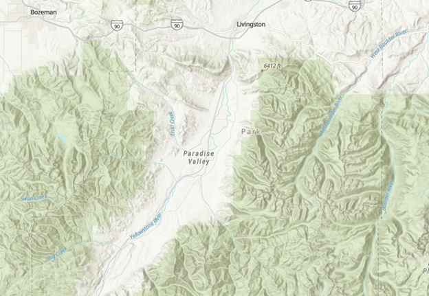
Map Viewer
View high detail topographic maps of the region using ArcGIS’s Map Viewer.
Originating on Yount Peak in the Absaroka Range and entering Montana in the town of Gardiner, the Yellowstone River drains 70,000 square miles of land, before it joins the Missouri River northeast of Sidney, Montana. In addition to an abundance of fish and wildlife, the Yellowstone River supports a wide variety of tourism, agricultural, industrial, and recreational uses. Native Americans have lived in the area for at least 13,000 years and have used various names such as the Elk River to identify it (Poônôkaiit”taa in Blackfeet and Ichílíkasháashe in Crow). Lewis and Clark learned the name Meé,-ah'-zah—literally, "stone river" from the Hidatsas, and adopted the French roche jaune, literally "yellow stones" to describe it in their famous journals.
The Upper Yellowstone Watershed Group focuses it efforts on the Gardiner Basin and Paradise Valley sub-regions of the Upper Yellowstone River Watershed between the unincorporated community of Gardiner in the South, the Northern entrance of Yellowstone National Park, to the city of Livingston, Montana, to the North. The landscape has a rich history of agriculture, preservation, exploration and recreation.
[Click on the map to expand]